Archive
A Slight Change of Plans
We were running behind schedule due to stopping to assist at a fatal road accident, and due to slower than expected progress on the Laura Coach road. In order to attempt to be on time at our scheduled stop, we elected to change the itinerary, skipping Lakefield NP on the way North, instead doing it on the way south.
That meant today would be a long but easy run up to Archer River , where we had a beautiful campsite.
The morning was spent viewing spectacular aboriginal rock art.
Old Laura Coach Road 2
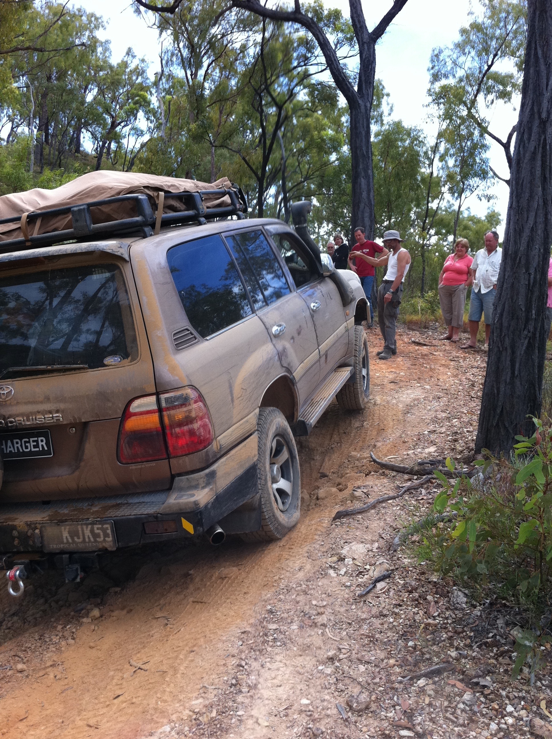
We left Jessop Ck early, refreshed and ready to tackle our second day on the coach road. Immediately upon leaving camp we were confronted with more washed out creek crossings and rough terrain. It was very slow going all morning. Our morning tea break arrived without any incidents or recoveries required. After our break, we encountered a couple of very steep climbs that required the lower clearance vehicles to be very choosy about their line. Craig’s Mazda had to have two attempts at one climb, but a little guidance saw success on the third attempt.
At about the time Craig was having his third attempt, a 4WD club came up behind us. As the law of the tracks dictates we let the smaller faster convoy overtake us.
In short order we found ourselves crossing the Little Laura river and then onto the good gravel road. Along the way we stopped to assist some
ringers from Olive Vale station who had a ute with a flat tyre. Gathered around the ute was a group of horse riders. A helicopter sat idling beside the road. As soon as the tyre repair was complete the helicopter pilot lept in and the chopper was gone in seconds.
Our visit to Laura coincided with the State of Origin match, so we all had dinner at the pub and watched QLD flog NSW again.
Townsville to Undara Lava Tubes
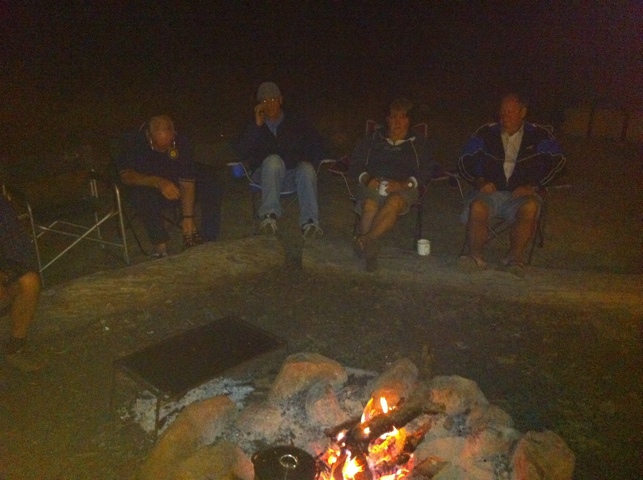
Today got off to fantastic start even tho we were a little late getting away. We explored some local history and aboriginal art on the way. It was a pleasant drive with few road trains to bother us. We had a short lunch stop in the shade of a very old she-oak on the bank of the Clarke River, followed by a refuel for the vehicles at Greenvale before moving on to Undara. A campfire kept us warm as we all got to know each other over dinner.
2012 4WD Tour Calendar Now Available
We’ve just finished putting together our 2012 4WD Expedition Calendar. This is the calendar for our longer tours of 8 days and more.
The calendar is available for download from our web site
So far we have dates planned for
8 Day Simpson Desert 2012
10 Day Hay River 2012
20 Day Cape York 2012
23 Day Canning Stock Route and Gunbarrell Highway
We may also add a 21 Day Kimberley and another Cape York Expedition is we have enough interest. So if you are interested in these tours, please contact us.
Cape York Adventure July 2011
We are off to Cape York again this year- Tour almost full. Here is a video of me dragging a snake to where everyone could see it
David Olsen
Director, Olsen’s 4WD Tours and Training
36 Octagonal Crescent , Kelso, QLD 4815
4WD Training
Cape York
Simpson Desert
Hay River
Kimberley
Canning Stock Route
Phone: +61 7 4789 3289
Fax: +61 7 4789 3298
Eyre Creek- Simpson Desert
I’ve been studying the creek and river heights for Eyre Creek in particular to assess the situation with respect to our tour beginning 28 May.
The data shows the creek height at Glengyle to be the same height as it was at the same time last year despite the local rain. This is good news, because the Eyre Creek Northern Bypass opened on 14 May last year. That gives us about 3 weeks leeway as long as it doesn’t rain too much more in the northern catchment.
Still Places Available on Both Simpson Desert Adventures.
We have two tours running through the Simpson Desert this year.
Our 8 Day Simpson Desert Tour runs from Alice Springs to Birdsville.
8 Day Tour
Alice Springs to Birdsville- Simpson Desert Crossing
28 May 2011 – 4 June 2011
10 Day Tour
Hay River Birdsville to Winton QLD via the Northern Simpson Desert
9 June to 18 June
Experience the Worlds largest parrallel dune system. See the wonders of the Simpson Desert
Travel safely with an experienced guide .
Located within the driest region of the Australian continent, the Simpson Desert is one of the world’s best examples of an erg or dunal desert, a sea of parallel red sand ridges some 300 – 500 kilometres long covering a total area of more than 170,000 square kilometres. The mean annual rainfall of 130 millimetres is very variable and unpredictable. Summer temperatures can exceed 50° C.
The Simpson Desert lies across the corners of 3 States, South Australia, Queensland and the Northern Territory, with the South Australian section divided into 3 protected areas, Simpson Desert Conservation Park, Simpson Desert Regional Reserve and Witjira National Park.
Although many people imagine the Simpson desert to be a huge sea of sand void of plant and animal life, the truth is very different. The desert changes almost continuously as you travel across it. The views are often breathtaking. The sky is immense and so is the landscape. This is big sky and big dune country at its best.

Early risers will be greeted with the most incredible colours at dawn, and the calls of numerous birds including the Crested Bell Bird. A morning walk along the dune crests will reveal tiny footprints of the hopping mouse, lizards and small marsupials.

The journey to the Simpson Desert via the Old South Road and the historical Ghan railway line is perhaps one of the most interesting and picturesque desert journeys you can do. The route abounds in history, both aboriginal and european and some of the most amazing geographical formations tell of a much wetter past.
Traveling the Simpson Desert via motor vehicle is not for the inexperienced, that is why a tag-along tour is one of the best ways to experience the desert. I personally have witnessed a convoy of eight vehicles reduced to a convoy of just three due to inexperience. Given that vehicle recovery costs from the desert could be more than $4000, a tag along is a great investment.
A HF radio such as carried by your tour guide, and an essential safety item may cost more than three times the ticket price for this tour. Cross the desert the smart way, with our tag-along tour. Get your head out of the maps, and enjoy the scenery.
Simpson Desert in Bloom- 2011
The rain is coming down all over the Simpson desert right now. Assuming Eyre Creek bypass opens in time, ( I am confident it will) we are going to have one of the best years in the desert. Last year was incredible with wildflowers everywhere, but this year is looking even better, especially along the Hay River. Our Hay River Tour still has places available, and leaves Birdsville June 9th.
Simpson Desert Hay River Price Drop
Price Drop- 10 day Simpson Desert Hay River Trip was $1936, now $1636.

Tony and others watching the sun rise

Crossing flooded Eyre creek Day 1

Last year the wildflowers were amazing- we expect the same this year


ph 07 47893289/ Olsen’s 4WD Tours and Training. http://www.djolsen.com
Nolans Brook to The Top
The crossing of Nolans Brook is always interesting. Many people just do not take enough care, and that is why 20 cars per week are drowned there in peak season.
Our crossing preparation was like a military operation, and the campers looking for entertainment gathered to watch, probably keen to see some carnage. Everyone crossed safely, and to our surprise there was loud applause and many compliments from the gathered throng.
North of Nolans can be pretty exciting. The trip is certainly not over once you get through Nolans Brook. We did not travel to the Jardine this year due to earlier delays, instead we went on to Bamaga and to Loyalty Beach. The following day we drove and walked to the tip and celebrated our safe arrival.
Join us on our 2011 Cape York Tag-Along Tour. Book at www.djolsen.com


